


Page 16 - sst_class_06
P. 16
Chapter  3             maps


             A map is a two-dimensional scaled representation
             of the Earth’s surface or part of it on a flat surface.        Cartography is the art and science of
             They are easy to handle and they can be taken to  map making. It also involves production
             the  field  by  explorers  or  tourists.  Maps  can  give  of maps. Cartogram is a type of map,
             more detailed and  diverse information  on small               using statistical information. Legend is

             areas because they can be drawn on large and small             the key to the symbols used on a map.
                                                                            A book of maps is called an atlas.
             scale. Further more, maps are easily reproduced in
             large number. For all these reasons, a map is the most important tool of geographic studies.
                                                  maPS aCCorDing to SCale

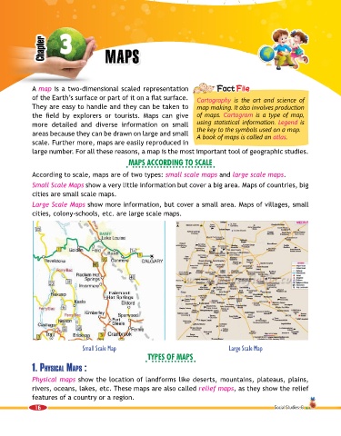
             According to scale, maps are of two types: small scale maps and large scale maps.

             Small Scale Maps show a very little information but cover a big area. Maps of countries, big
             cities are small scale maps.

             Large Scale Maps show more information, but cover a small area. Maps of villages, small
             cities, colony-schools, etc. are large scale maps.


                                Small Scale Map                                         Large Scale Map
                                                         tyPeS of maPS
             1. PhySiCal MaPS :

             Physical maps show the location of landforms like deserts, mountains, plateaus, plains,
             rivers, oceans, lakes, etc. These maps are also called relief maps, as they show the relief
             features of a country or a region.

              16                                                                                         Social Studies-6

