


Page 28 - sst_class_06
P. 28
Most of the states are formed on the basis of languages. The states are further divided into
             districts and tehsils.

                 •   Rajasthan is the largest state and Goa is the smallest state in area.
                 •   Uttar Pradesh has the highest population and maximum number of districts.

                 •   Uttarakhand, Uttar Pradesh, Bihar, West Bengal and Sikkim have common boundaries
                   with Nepal.
                 •   Uttarakhand, Jharkhand and Chhattisgarh are the new states which were created
                   from Uttar Pradesh, Bihar and Madhya Pradesh respectively.

                 •   Jammu and Kashmir, Himachal Pradesh, Uttarakhand, Sikkim and Arunachal Pradesh
                   have common boundaries with China.
                 •   Sikkim, Assam, Arunachal Pradesh and West Bengal have common boundaries with Bhutan.
                 •   Some states share the common boundaries with neighbour countries.

                 •   Gujarat, Rajasthan, Punjab and Jammu and Kashmir share their boundaries with
                   Pakistan.

                 •   West Bengal,  Assam, Meghalaya,  Tripura  and            NCR  or National  Capital  Region  of
                   Mizoram have common boundaries with Bangladesh.            Delhi includes the townships of Noida,
                                                                              Ghaziabad, Faridabad and Gurgaon.
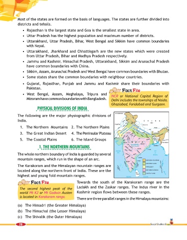
                           PhySiCal DiviSionS of inDia

             The following are the major physiographic divisions of
             India.

               1.  The Northern  Mountains   2. The Northern Plains
               3.  The Great Indian Desert  4.  The Peninsular Plateau

               5.   The Coastal Plains             6.  The Island Groups

                            1. the northern mountainS


             The whole northern boundary of India is guarded by several
             mountain ranges, which run in the shape of an arc.
             The Karakoram and the Himalayan mountain ranges are
             located along the northern front of India. These are the

             highest and young fold mountain ranges.

                                                      Towards the  south  of the  Karakoram range are the
               The second highest peak of the         Ladakh and the Zaskar ranges. The Indus river in the
               world Mt K2 or Mt Godwin Austen        Kashmir region flows between these ranges.
               is located in Karakoram range.
                                                      There are three parallel ranges in the Himalaya mountains:

             (a)  The Himadri (the Greater Himalaya)
             (b)  The Himachal (the Lesser Himalaya)
             (c)  The Shivalik (the Outer Himalaya)


              28                                                                                         Social Studies-6

